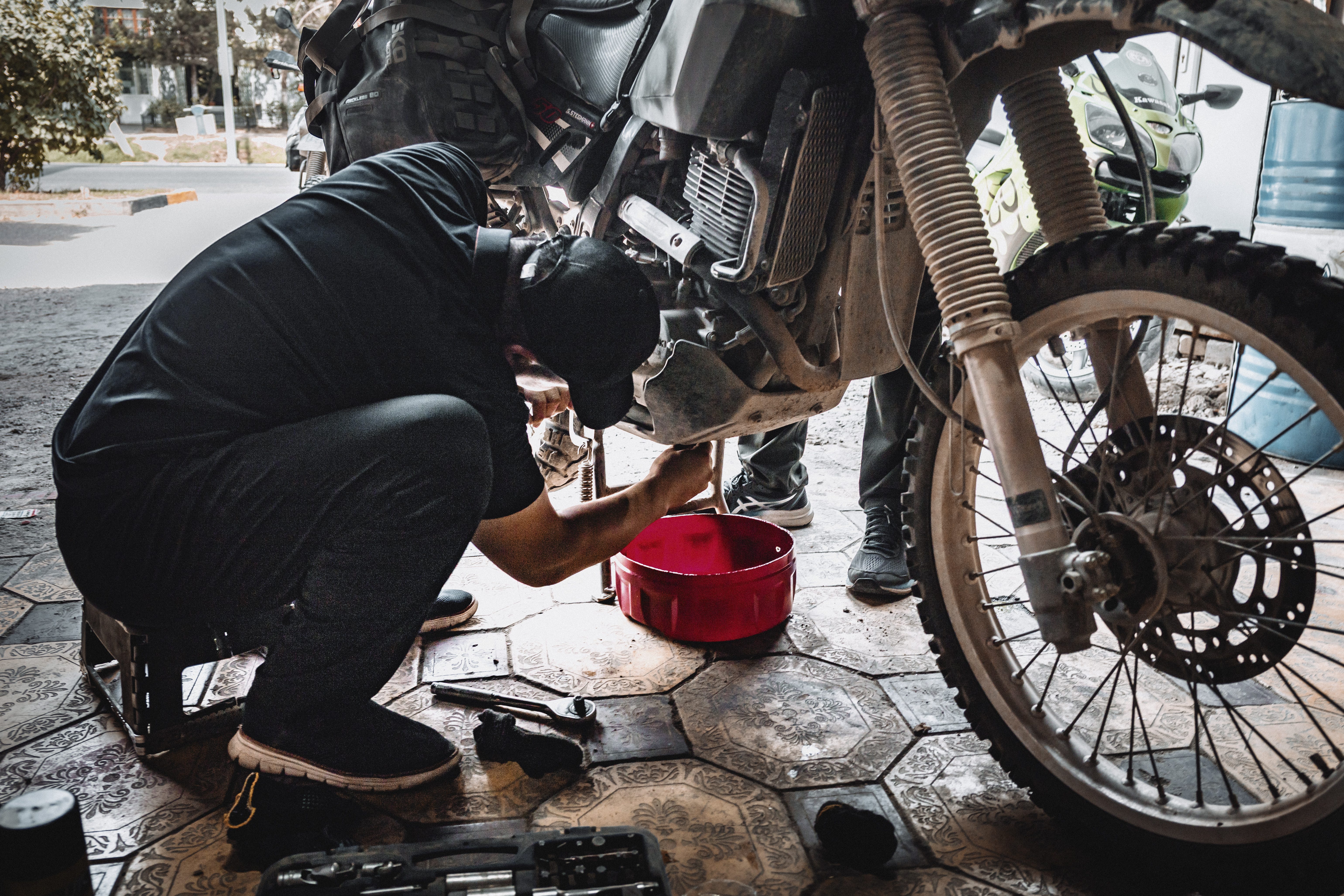
Day 63 to 66 - Let’s just say we had a blast. Dushanbe. We really needed to relax and take a break. Shave off our beards and get a fresh haircut. Sleep for 10 hours each night in the nicely cooled rooms at the youth hostel. Get our bikes prepped for the remote Pamir region; they needed an oil change big time. Lick our wounds and heal our aches. My "good" left knee is in bad shape, could be meniscus damage or maybe a ligament issue. In Kabul, Gion fell, and with il his bike on his foot from a 50 cm border, resulting in a couple of bruised toes and a swollen foot. He got lucky. Not so lucky was the Italian biker who broke his leg in the Pamir mountains. His bike is still here in Dushanbe in the mechanic shop; he flew back to Italy to recover. While unwinding at Dushanbe's modern cafes and restaurants (yes, we even indulged in the local KFC), we planned our route through the Pamirs. We needed two permits: the GBAO permit for access to the Gorno-Badakhshan region we need to ride through along the Afghan and Pakistani border, and the Kyrgyz border permit to enter Kyrgyzstan from Tajikistan. We managed to get everything sorted and hope it will get us through the expected five checkpoints along the Pamir Highway. One last Weizen tonight, and then we’re off.


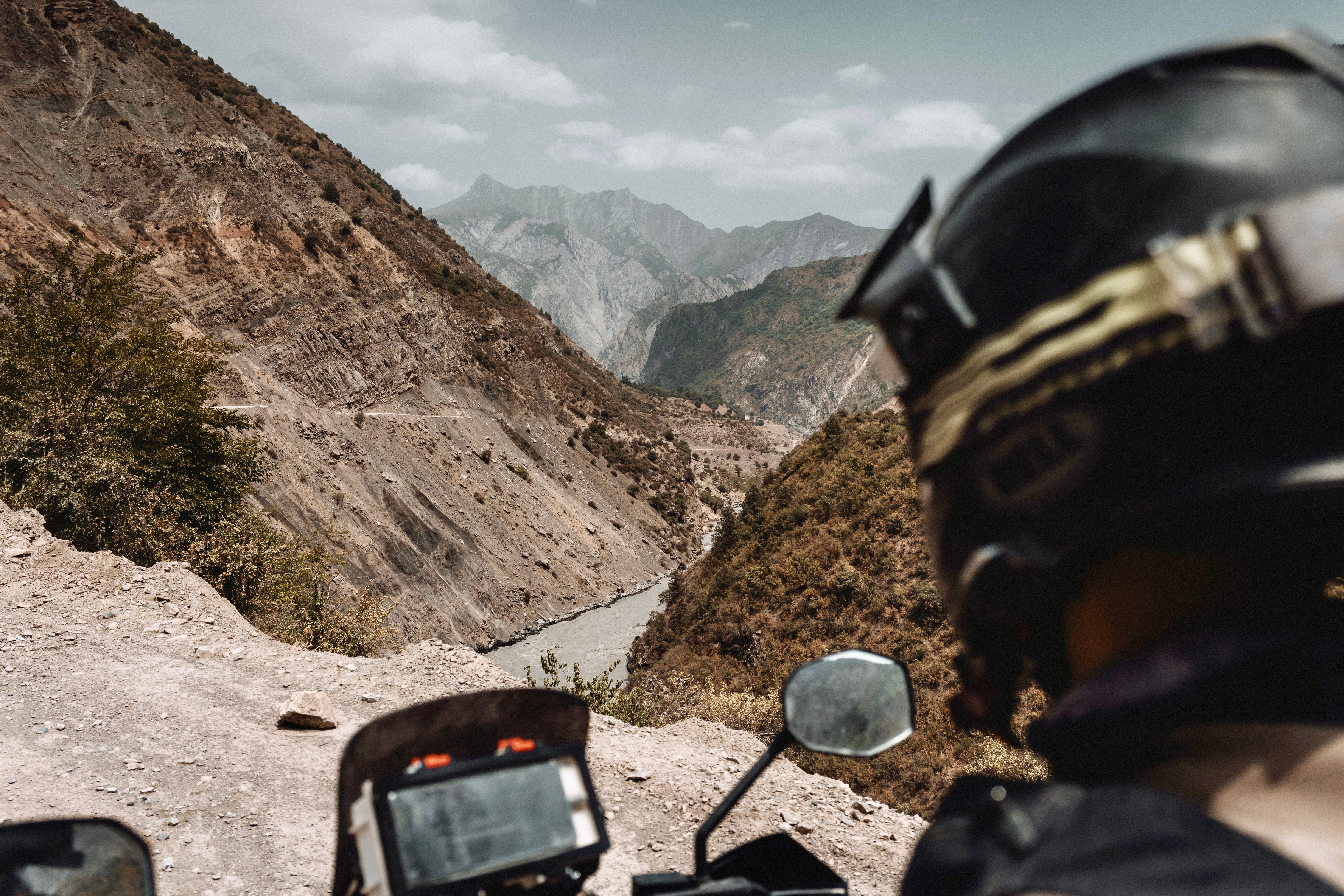
Day 67 - Pamir Highway. This has been a dream of mine for years, ever since I stumbled upon an article about this mystical road that only the bravest adventurers dare to travel (slight exaggeration alert). About a decade ago, the kids and I had this plan to rent a 4x4 and hit this road, but life got in the way. So when Gion and I were searching for a route, this one popped back into our minds, besides the Road of Bones in Siberia, another one still on the list. In short, after over 11’000 km of riding through some of the most unexplored roads in this planet, we are finally… at the beginning. The legendary Pamir Highway, officially known as the M41, is the second highest international road in the world, right after the Karakorum Highway. It starts in Dushanbe and ends in Osh, Kyrgyzstan. The route is reaching pleateaus of heights between 3,000 – 3,500m, and then climbs even higher to 4,655m at the famous Ak-Baital pass. This road is “naturally” rough and is a haven for “off-road” enthusiasts, but it also suffers from landslides, earthquakes, avalanches, and overflowing rivers. Excited, we leave Dushanbe on the M41, which is still relatively tame and paved for about 150 km, as we kick off our first day on the Pamir Highway. Before long, the road turns unpaved again, climbing through lush green valleys alongside rivers to a plateau around 1500m. Calling it a “highway” is a bit of a stretch; in Belgium, we’d probably label what we’re driving on as a mountain or forest road, barely passable without a four-wheel drive. Here, truckers with balls of steel, see no issue passing it with their flatbeds. We ascend the slopes and set up camp for the night at the Khaburabot pass, which sits at 3200m. It still looked like it could be somewhere in the French Maritime mountains, so we’re curious about when the Pamir mountains will make their appearance.


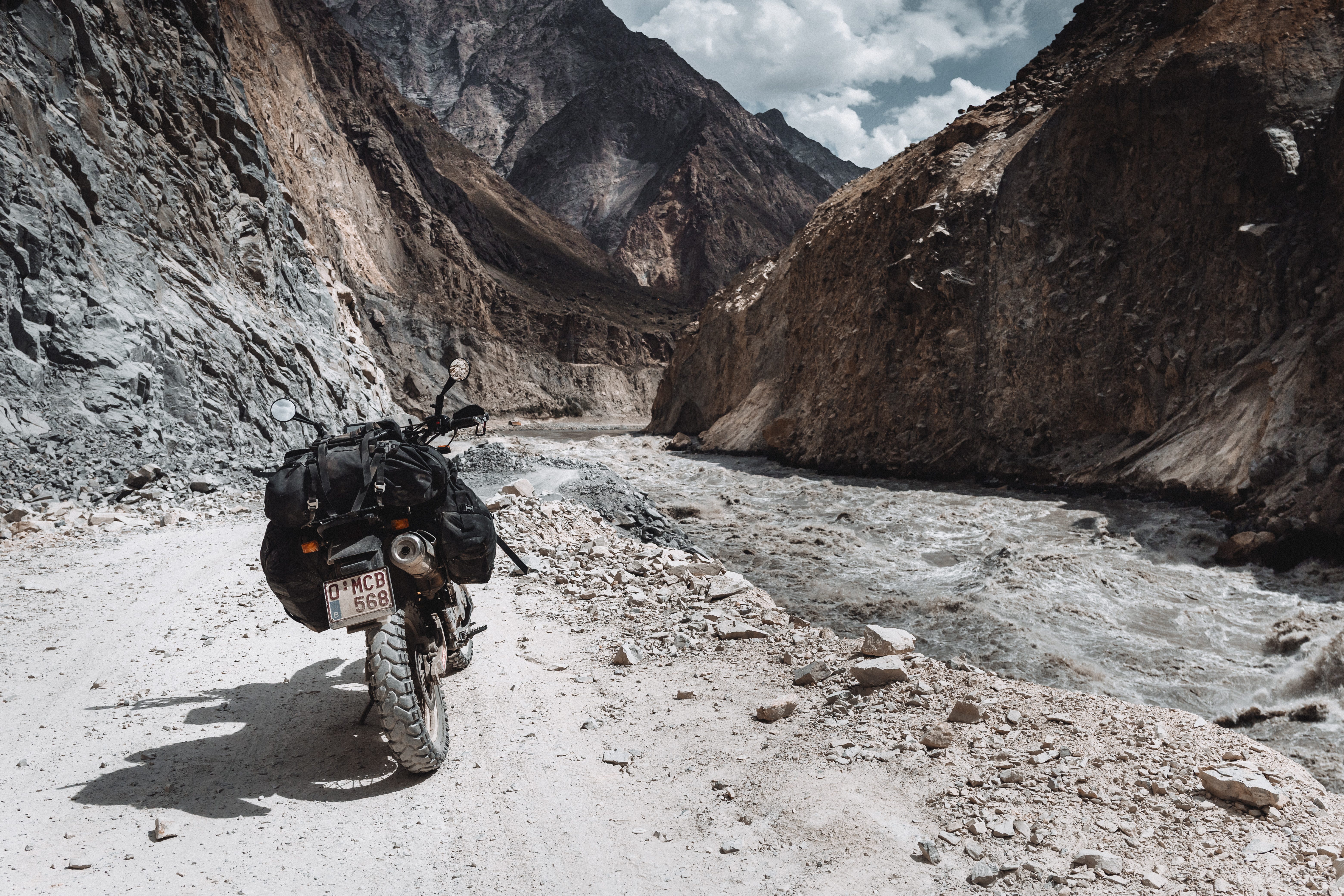
Day 68 - Afghanistan! We missed you. Kind of. Now, we see it across the river as the Pamir Highway takes us into day two, running along the Tajik-Afghan border. The Pyanj River, stretching 921 km, serves as a natural divider between the two nations. On one side, we spot the typical Afghan villages and the white flag of the by the international community largely unrecognised Islamic Emirate of Afghanistan, while on the Tajik side, we make our way through the rough gravel and sand of M41. The border is heavily patrolled by armed Tajik soldiers with natural stipend shooting positions every 500 m or so allowing a clear view on Afghanistans green villages and mountain peaks. And on the Taliban. We carry 10 copies of our passports, the Tajik visa extension that lets us stay for up to 30 days, and the GBAO permit that allows us to enter the Gorno-Badakhshan Autonomous Region. At each major Tajik checkpoint, we hand a copy to the soldiers, who let us pass after inspection of said copy. The mountains are becoming more majestic, with seemingly vertical walls leading to snowy peaks as we follow the river deeper into the Central Asian mountains. The route has turned rough, it’s like driving on a washing board, and we're only managing to make an average speed of 30 km/h in order not to put too much strain on our forks and bikes. And on ourselves for that matter. We set up camp in a beautiful spot right at the road junction towards the Bartang Valley. Initially, we planned to ride up the valley, but we've been told that it's closed due to too many impassable river crossings this season. Time for rest. I'm wiped out; 10 hours of riding have taken their toll. I hit the sack at 8 PM and wake up at 7 AM, feeling like the 11 hours of sleep was just about the bare minimum I need to keep going. I've been blaming my digestive system acting up for days now. The dry biscuits and electrolyte-rich water I've been sticking to lately to give my gut a break don't seem like the best nutrition for handling the daily abuse we take. Welcome to Central Asia, where sky-high mountains and hard-hitting gastro problems go hand in hand.